Block 36
Started as an investigation of my house and who has lived in it over time, this work blossomed into an extended investigation of my whole block — Block 36. As I dug into the lives of those who lived on Block 36 from 1900 to 1950 and read the news of the time, I was struck by the degree to which the social and political context of each era played out right here, on Block 36.
The prevalence of child labor, the Anti-Chinese movement, the time before any social safety net existed, the ravages of uncontrolled diseases, the impact of World Wars, Japanese internment camps, and the Great Migration — all this and more is manifest in the lives of those who lived on my block.
While my focus was first on observing change over time, it soon became unavoidable to notice those things that have not changed: poverty, extreme gaps in children's opportunity to learn, street crime, intense and persistent racism, domestic abuse of women, systematic environmental degradation, complaints about taxes, anti-vaxers, the need for street repairs, scarcity of water, and more. It's all still here.
Recognizing that these circumstances persist is when I realized that this hyper-local dive into the history of those living on one square block can, in fact, provide broad perspective and insight.
Fifty Years of Block 36.
An ~80-page written narrative — Block 36, decade by decade, from 1900 to 1950 — lives in the source PDF.
Download the PDF →Berkeley's West End, 1900
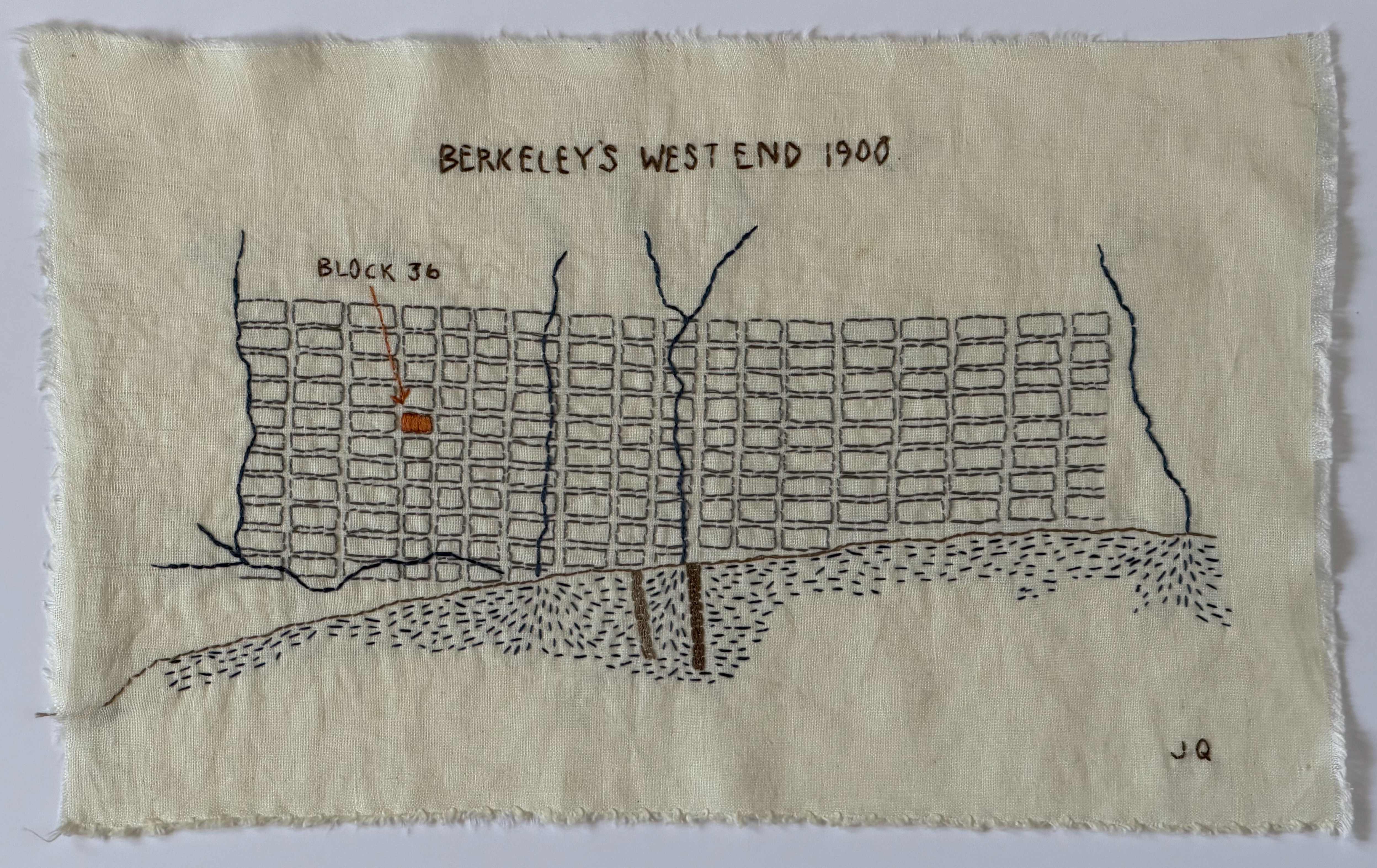
A hand-stitched map of Berkeley's West End, circa 1900, showing where Block 36 was located.
The block bounded by Sixth and Seventh Streets between Page and Camelia Streets was known as Block 36 of Tract B of the Berkeley Land and Town Improvement Association — the group formed in 1873 to promote settlement in the flatlands. The Association purchased a large portion of the land in West Berkeley and then marketed and sold land parcels to interested buyers.
West Berkeley, known first as the unincorporated "Ocean View," then as Berkeley's "West End," was the scrappy sibling of University-focused East Berkeley.
Notice the landscape.
Used for drinking water, irrigation, and sewage disposal.
The Bay Bridge wouldn't be built for another 25 years.
A Slice of Berkeley's West End, c. 1911
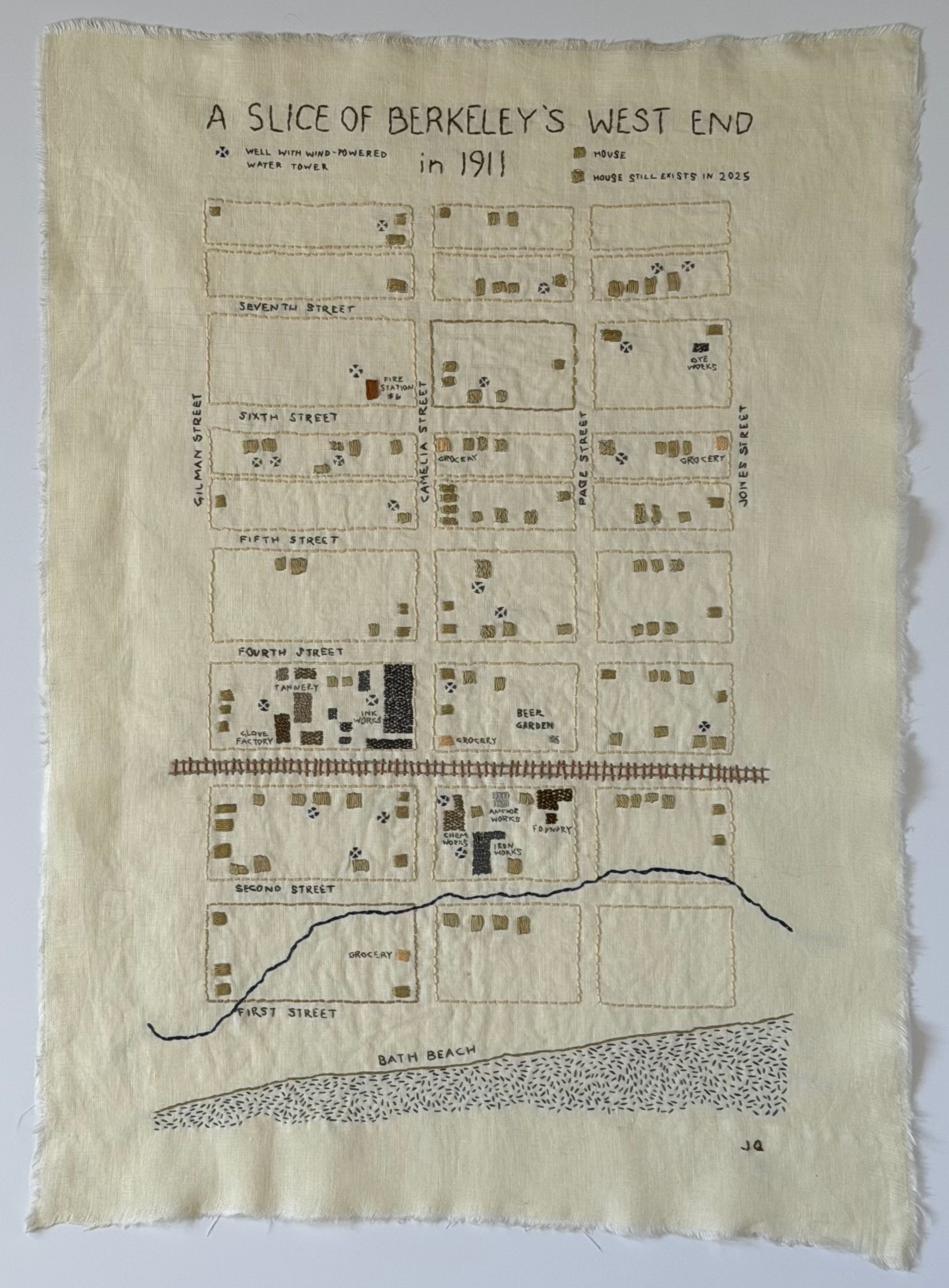
This stitched map shows the portion of the West End that encompasses Block 36.
At its beginnings, filled with saloons, vibrant businesses, and all-manner of industry, the West End was populated by a largely working class, immigrant community — something that remained essentially true for many decades.
Shown here is the proximity of industry, the railroad, and the Bay to Block 36.
What to find in the stitching.
This mixture characterized the West End.
There were no supermarkets.
One still exists today in this location.
Note how many there were.
Time Series View of Block 36
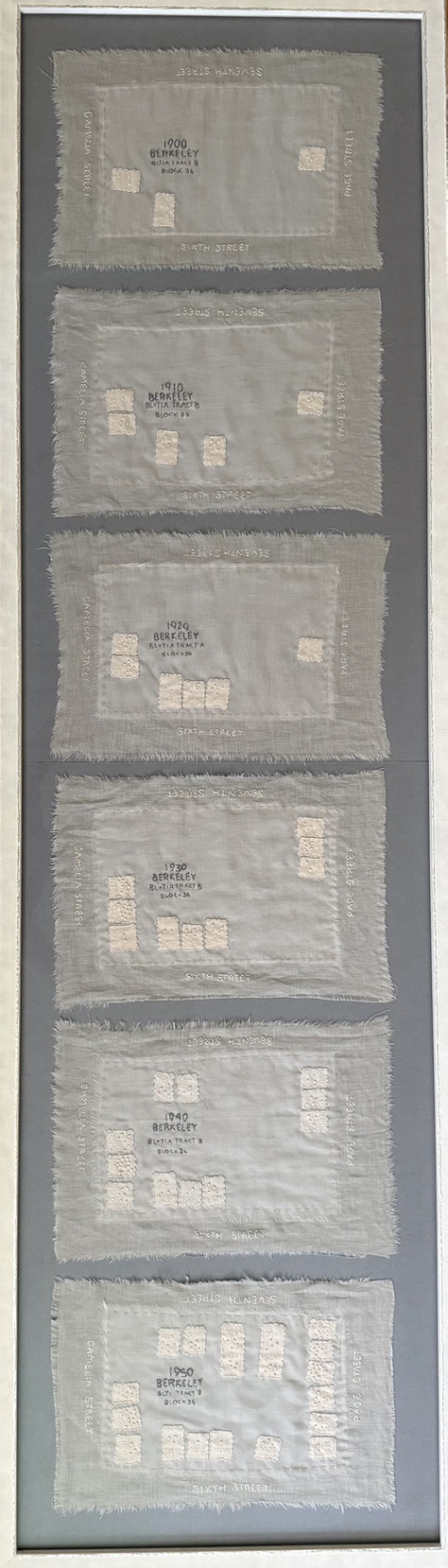
A hand-stitched snapshot of the homes on Block 36, designed to provide a visual image of constancy and change on the block from 1900 to 1950.
In addition to showing how the land was developed over a 50-year period, this piece surfaces a much simpler and more concrete reality — the number of individuals living in each house, at the start of each decade, as represented by the number of French knots placed in each home.
Seeing that as many as 9, 11, or even 14 people lived in the modest homes on Block 36 — typically comprising less than 1,000 square feet — hints at the social history of the block and the people living there.
The over-population of homes, a symptom of poverty, correlated more broadly to times of economic downturn, resulted from families with large numbers of children, multigenerational households, and the need to take in boarders. It was common in neighborhoods with recent immigrants or those where wage-earners had little education.
What Richness!
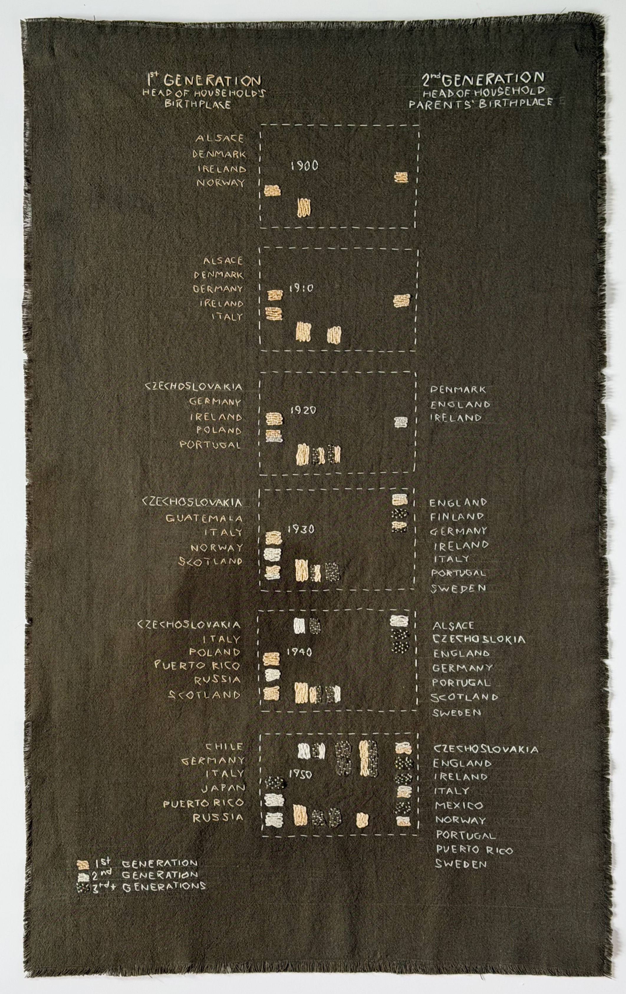
This embroidered table shows one aspect of the diversity of Block 36 residents and how it changed from 1900 to 1950. These differences in country of origin likely were associated with differences in home language, cuisine and cultural practices.
The table shows the origin of heads of household on Block 36 — by house, by country, by decade — and whether they were first generation (born in a different country), second generation (descendant of parents born in a different country), or third generation (descendant of grandparents born in a different country).
Notice how in 1900 and 1910, all heads of households on Block 36 were immigrants from Northern Europe. Over time, this gradually changed, as did the location of residents' origin countries. This work summons the extraordinary cultural richness of the diverse individuals who lived on this small piece of land.